
EnGIS Technologies

includes global automakers, Tier 1s, in addition to a range of industry partnerships.
For more information, please visit www.engistech.com.
EnGIS Connected eHorizon
The on-board map engine requests map data from the off-board map engine based on the location data from the vehicle sensors and the amount of map data required for lookahead in the routing direction and/or the most probable paths (MPP). Partial map data is stored onboard as a map cache. The off-board map engine connects to the map server enabling transfer of map data based on requests from the on-board map engine.

Figure 1 – EnGIS eHorizon Architecture
Automotive companies employ EnGIS eHorizon software to support use cases such as Intelligent Speed Assist (ISA), which alerts drivers to current and approaching speed restrictions using both implicit and explicit speed limit information. Other applications include driver assistance applications, such as dynamic speed sign display and predictive deceleration control which can be used in conjunction with end of traffic jam warnings or hazardous road condition warnings; and electric vehicle (EV) applications, such as drive range optimization and battery management. EnGIS eHorizon software is also used by transportation and fleet management companies to optimize vehicle and driver allocation, as well as to improve safety and convenience.
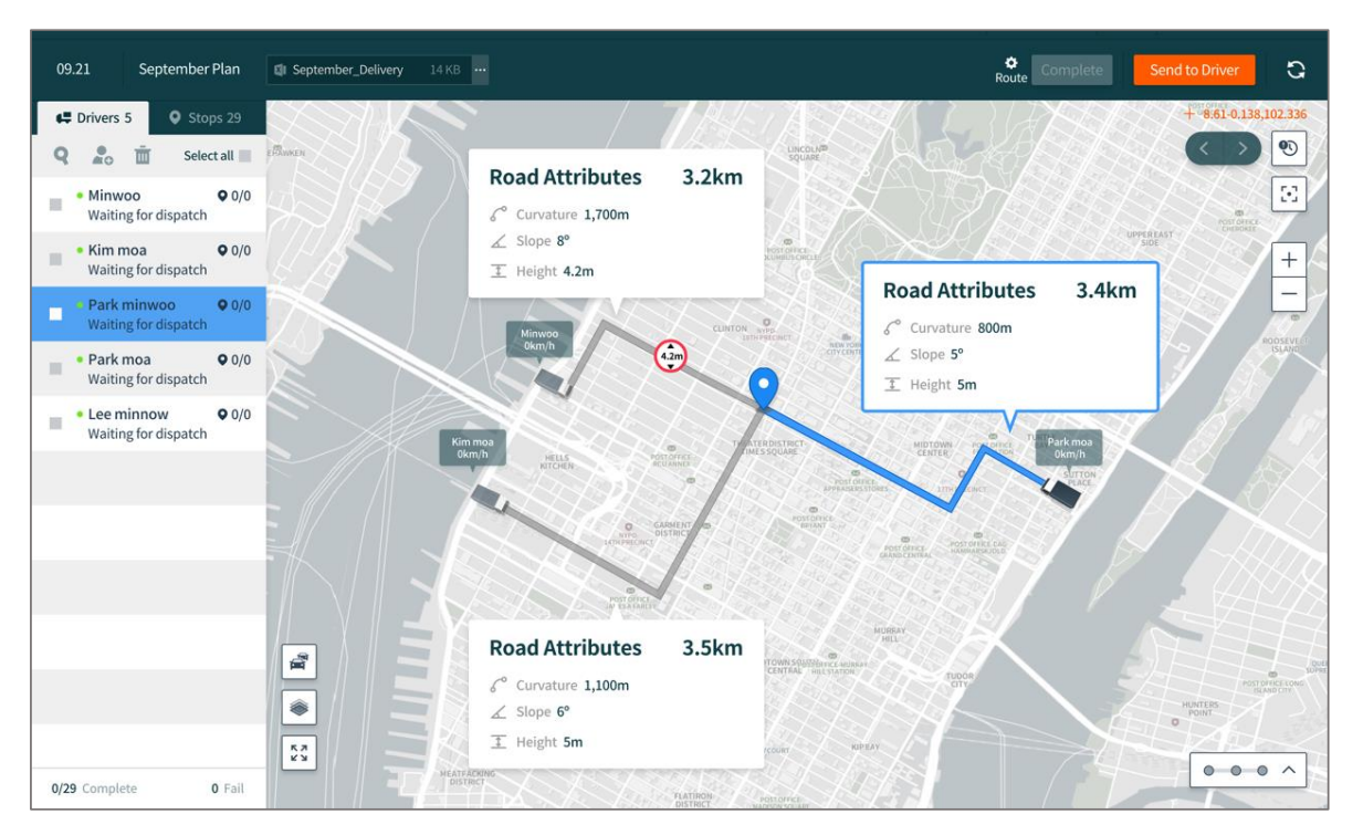
Figure 2 – EnGIS eHorizon in logistics use case
- Asia Head Quarters: Mr. Minsu Lee, CTO, Seoul, South Korea,
msjlee@engistech.com - ADASIS Forum: Mr. Daniel Scott, Product Owner: ADAS/Navigation, Galway, Ireland,
scott.daniel@engistech.com